Move through a changing shoreline.
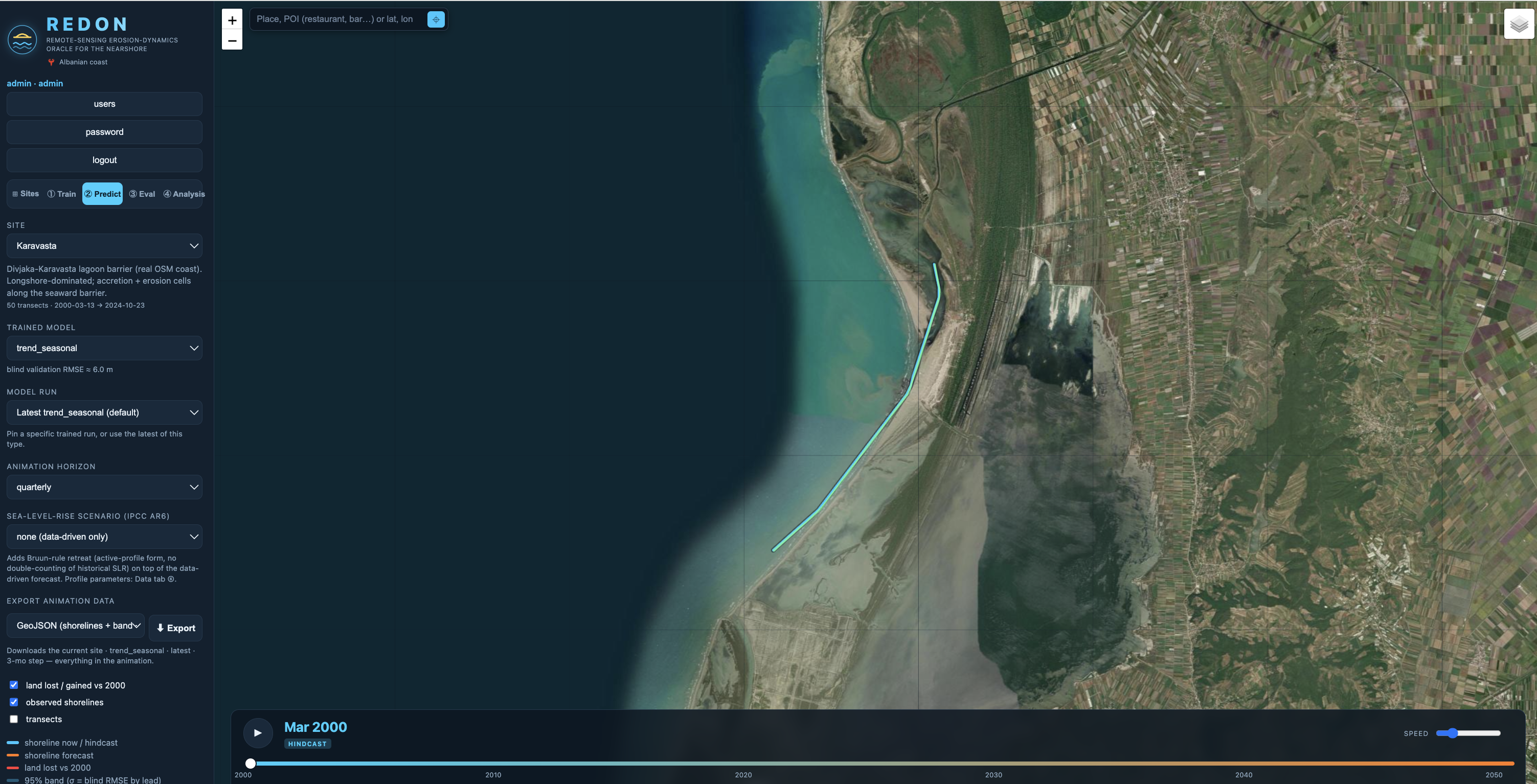
A map and time control make the record tangible, allowing a researcher or planner to move from observed history into possible futures without confusing one for the other.
A Softmachines work · Coastal intelligence
REDON makes shoreline movement easier to see, question, and act on, without making uncertainty disappear.
The premise
Coastlines change through tide, storm, sediment, rivers, vegetation, and human decisions. A single confident-looking prediction would hide more than it explains.
REDON brings satellite-derived observations, transects, alternative models, evaluation, and uncertainty into one place, turning a distant risk into evidence people can examine together.
A system for attention
A map and time control make the record tangible, allowing a researcher or planner to move from observed history into possible futures without confusing one for the other.
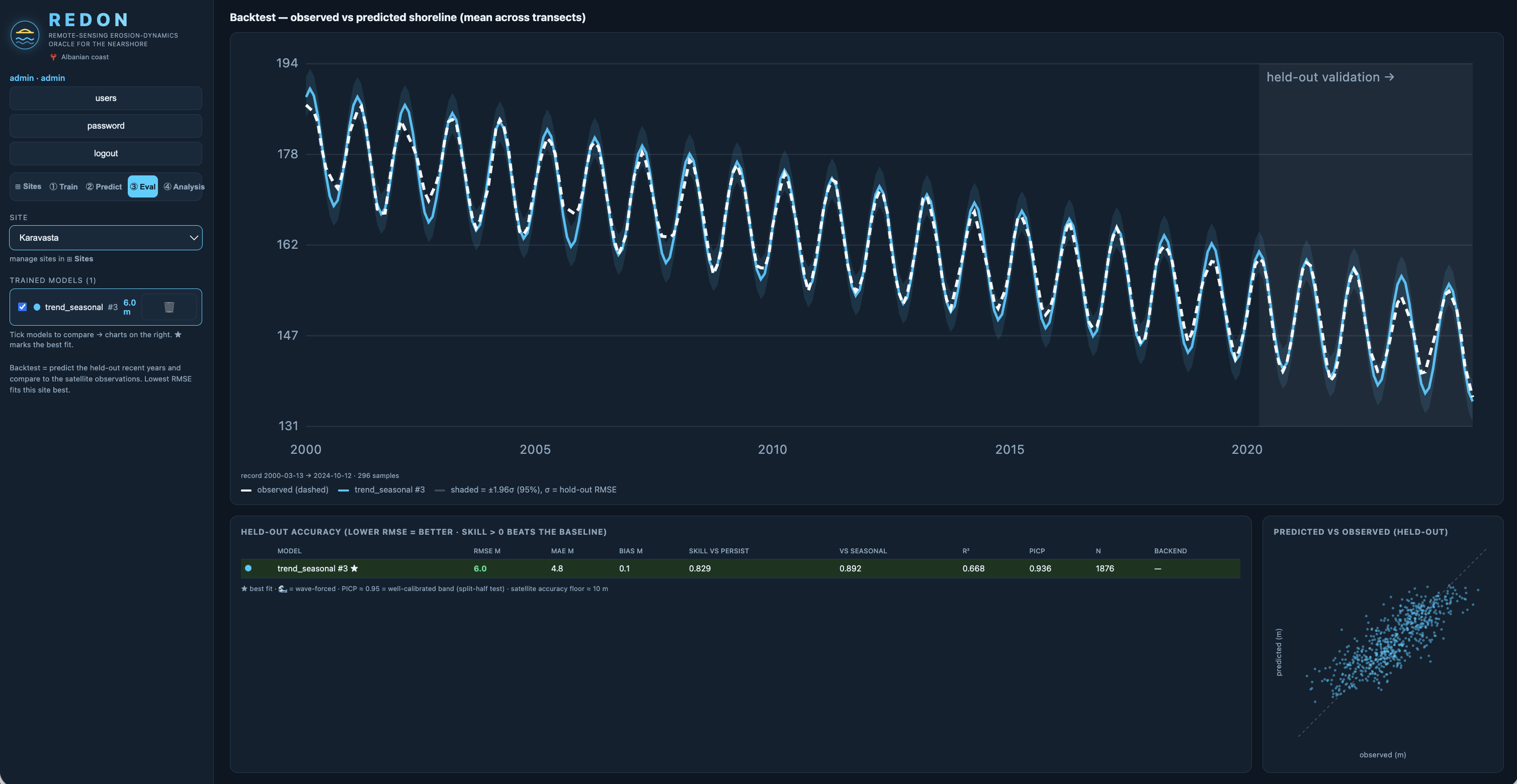
The evaluation view places errors, withheld observations, and transect behavior beside the forecast. It shows where a model matched reality and where it did not, so uncertainty becomes part of the decision rather than a footnote.
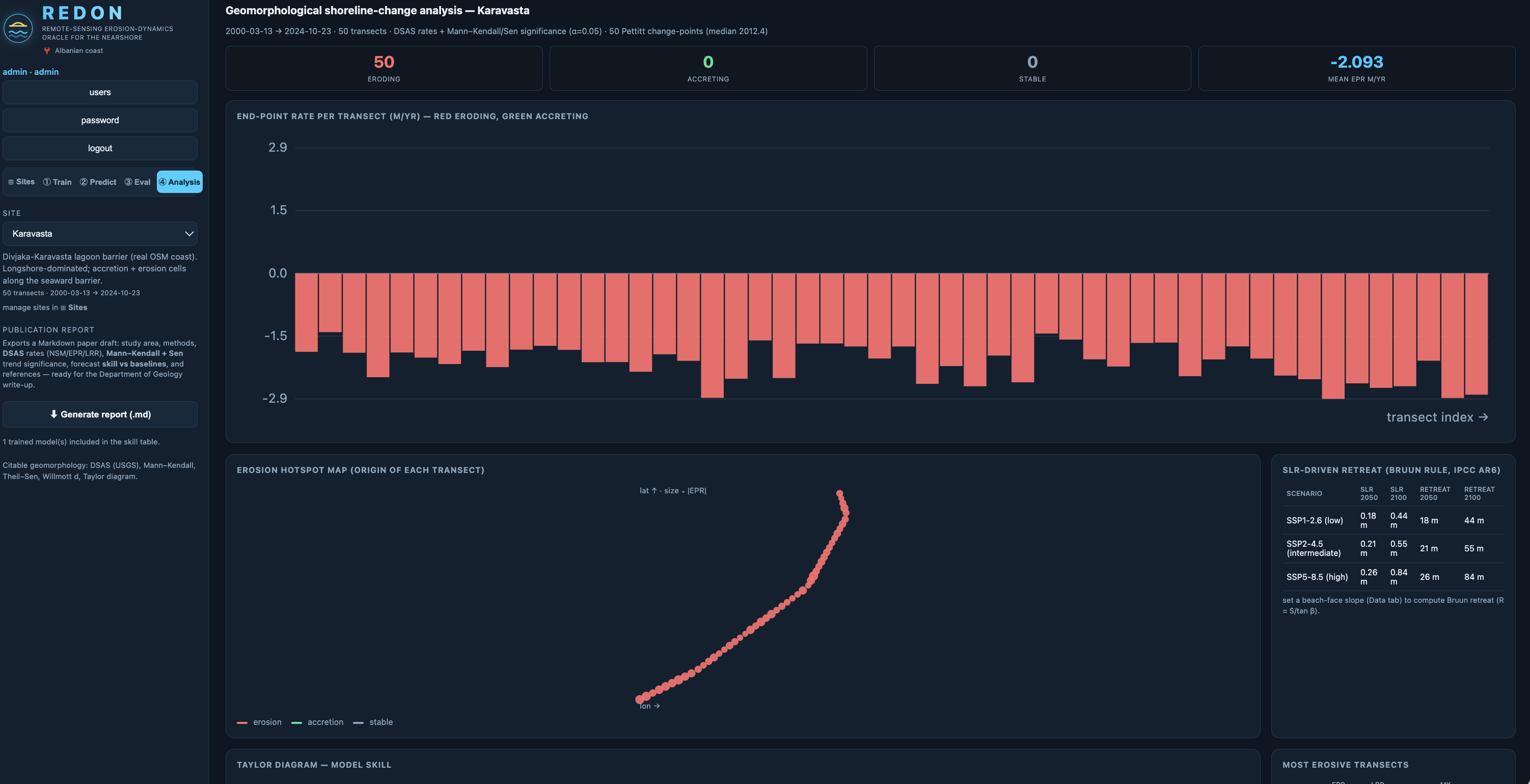
The analysis view exposes temporal structure and model behavior instead of reducing everything to a single line. Learning-based, trend, and hybrid physical approaches become alternatives a researcher can test, not authorities to obey.
The forecast timeline lets people watch observed and projected shorelines move through the same geography. Land loss, gain, transects, and confidence remain visible together, connecting statistical change to an actual coast.
Forecasting stack
REDON trains and compares several statistical, neural, foundation-model, physical, and ensemble approaches. Each model exposes a different assumption about how a shoreline changes, giving researchers alternatives to test against observations rather than one opaque answer.
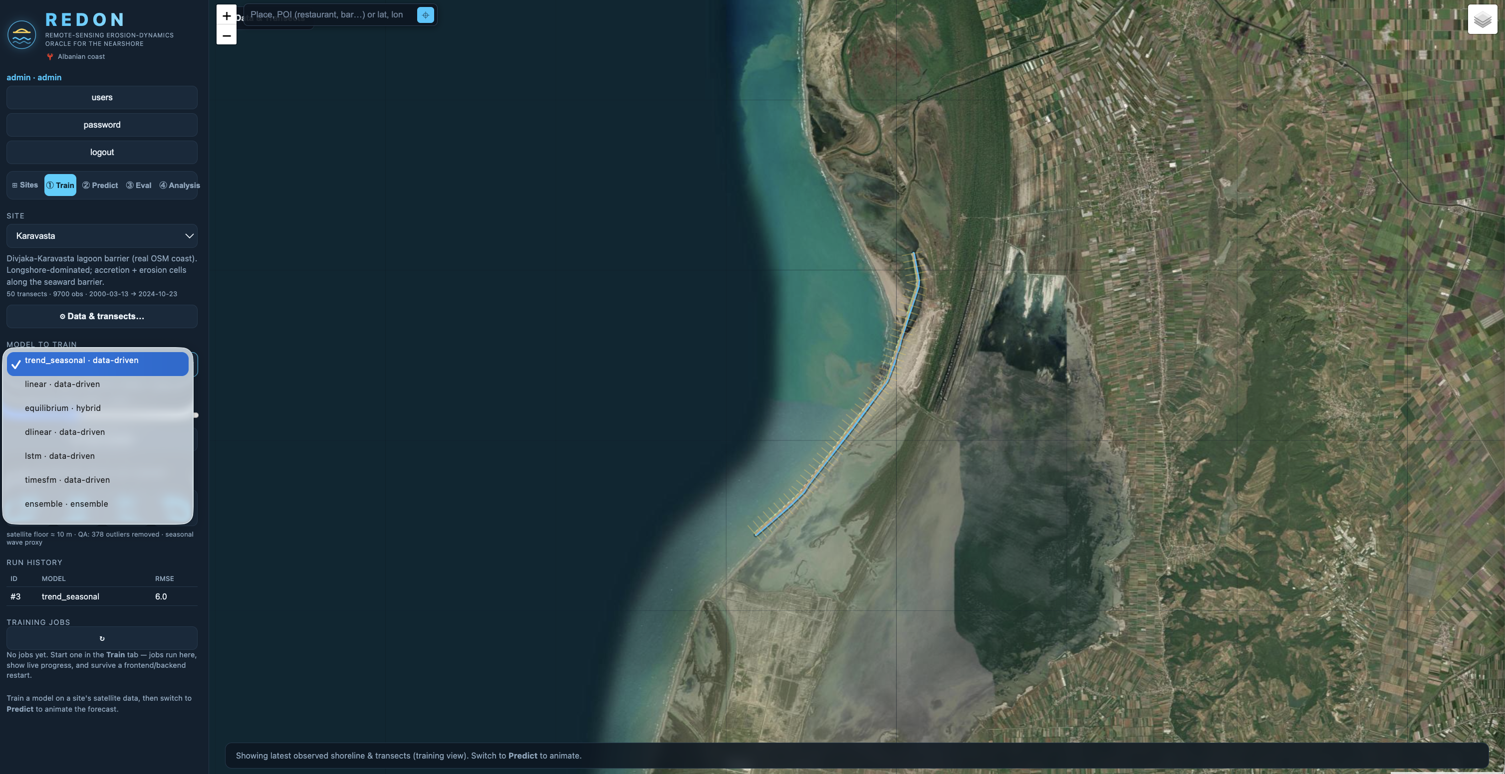
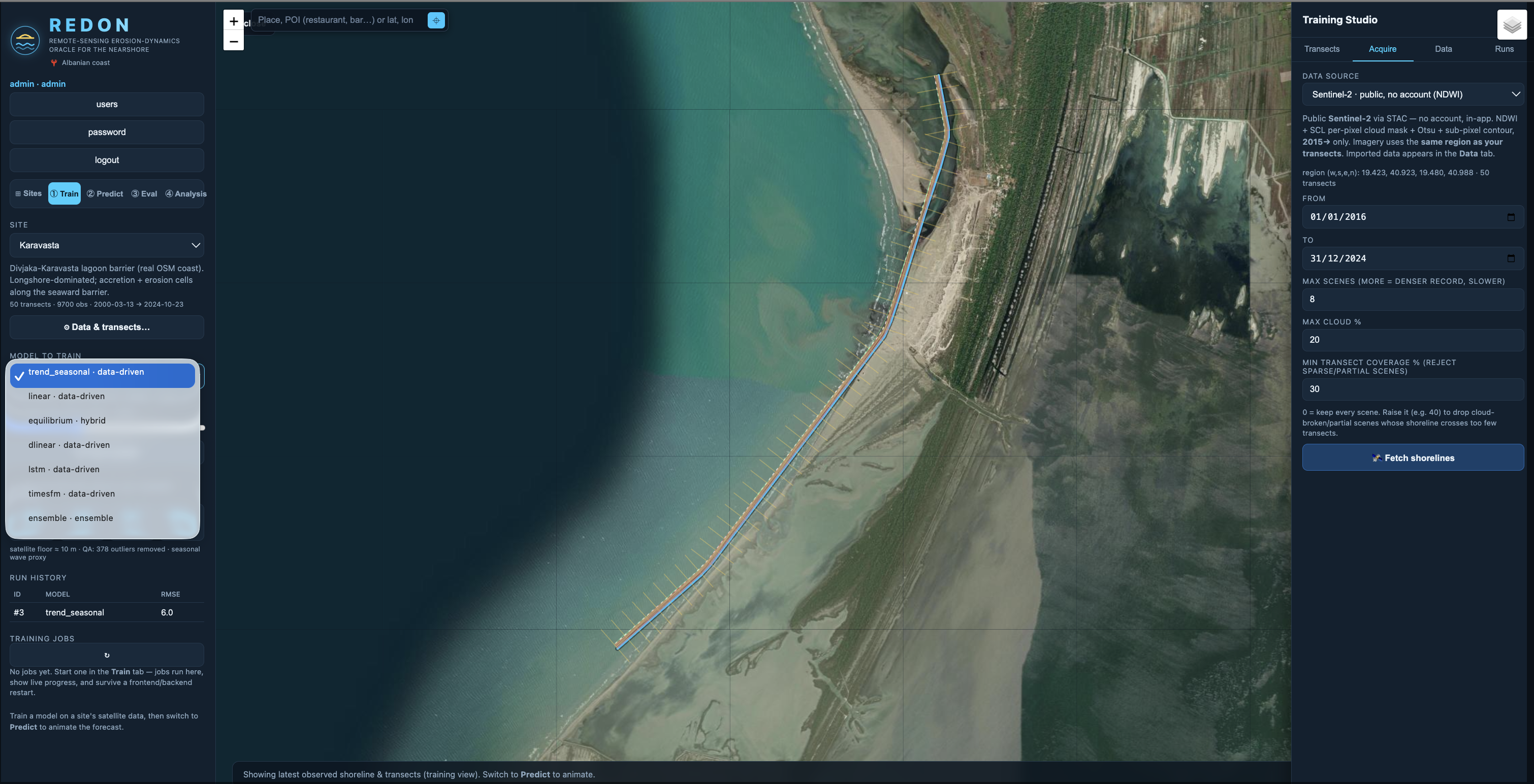
REDON organizes shoreline distance through spatial transects, removes flagged outliers during quality assurance, and learns from observations that may be unevenly distributed through time. Multi-transect training allows the system to recognize structure shared across nearby parts of a coast while preserving the behavior of individual transects.
Every run is evaluated against a withheld period the model did not see during training. Blind-validation RMSE, per-transect error, predicted-versus-observed trajectories, and lead-dependent uncertainty show where performance holds and where it degrades.
The selected model then produces a continuous shoreline trajectory and an uncertainty band for animation on the map. Researchers can compare runs, inspect the source data, and reject a technically impressive forecast when its evidence is weak or its assumptions do not fit the site.
Shoreline change is distributed across years, locations, and uneven observations. REDON uses learning-based forecasting alongside simpler trends and physically informed approaches to surface temporal relationships that are difficult to hold in mind one measurement at a time.
No model is allowed to turn weak evidence into certainty. Researchers remain responsible for the source data, site selection, model choice, validation period, and interpretation of error. The interface keeps those decisions close to the forecast so technical sophistication does not conceal its assumptions.
The larger aim is a shared habit of noticing change before it becomes irreversible: clearer evidence for researchers, planners, and coastal communities, and more time for public choices while choices still exist.
Earlier recognition creates more time to choose well.
Return to works